Another Western Disturbance Set To Hit North India This Weekend: IMD

Another Western Disturbance Set To Hit North India This Weekend: IMD

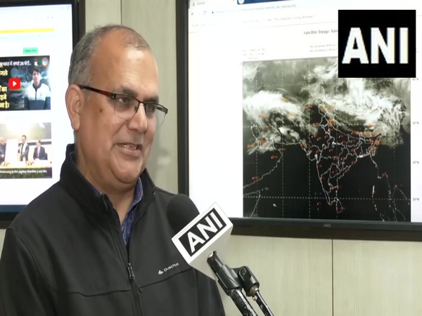
After the wet weather, induced by a western disturbance, prevailed across North India over the last few days, another western disturbance is set to alter weather conditions in the mountain regions this weekend, India Meteorological Department (IMD) Scientist Naresh said.

“Another Western Disturbance will start affecting from tomorrow which will lead to heavy snowfall and rainfall in the mountain regions. Rainfall and snowfall may be expected between 75 to 100 per cent of the stations,” IMD Scientist Naresh told ANI on Friday.

Naresh said that snowfall is expected in Jammu and Kashmir and Himachal Pradesh on February 4 and Punjab, Haryana, Western Uttar Pradesh and North-West Madhya Pradesh will experience light hailstorms.

“On the 4th of February, snowfall is expected in Jammu and Kashmir and Himachal Pradesh and light to moderate rain in plain areas are expected. Light hailstorm activities are also expected on February 4 in Punjab, Haryana and West UP and even in North-West MP,” the IMD Scientist said.

Naresh said the effect of the previous western disturbance lasted till Thursday, leading to intense snowfall in Jammu and Kashmir, Himachal Pradesh and Uttarakhand.

“If we talk about the past 4-5 days, Western Disturbance was seen in the Himalayan region and the adjoining plains. If you look at the satellite pictures, you can see that the system has moved forward, which had an effect till yesterday. This has led to intense snowfall in Jammu and Kashmir, Himachal Pradesh and Uttarakhand. In the plains, there was rainfall as well as hailstorms,” the IMD scientist said.

On the possibility of a rise in temperature since another Western Disturbance is set to alter weather patterns in north-west and central India, Naresh said temperatures will increase during the morning and dense fog may be expected in isolated pockets in Punjab, Haryana and Delhi NCR.

“Whenever there is Western Disturbance it leads to changes in wind patterns. So it leads to a rising tendency in temperature. So we do not expect that the temperature will drop in north-west India and central India. Temperatures will increase during the morning. Dense fog may be expected in the morning in isolated pockets in Punjab, Haryana and Delhi NCR,” Naresh said.

Naresh said there will be no prevalence of cold wave conditions in north India in the next few days owing to the western disturbance.

“There will not be a cold day, as temperatures will not drip in the next few days. So we are not expecting cold day in the next few days. We are also not expecting cold wave in the next 5-7 days,” he said.

Speaking about the weather pattern in the national capital, Lokesh said, “In Delhi, there might be light rainfall from February 3 to February 4.”

Several parts of the national capital received light-intensity rainfall on Wednesday afternoon under the influences of two western disturbances. (ANI)

For more details visit us: https://lokmarg.com/
General Supply of Petroleum Oil Lubricants

Modi Hails IMD For Its Exceptional Service To Nation

Prime Minister Narendra Modi on Monday hailed the India Meteorological Department for its exceptional service to the nation and said that the weather department has been instrumental in safeguarding lives and enhancing the understanding of the environment.

IMD celebrates its 150th year of service to the nation with yearlong celebrations commencing from January 15, 2024, to January 15, 2025.

Referring to this, PM Modi posted on X, “Today we mark 150 years of the India Meteorological Department’s exceptional service to our nation. From pioneering weather forecasting to advancing climate research, IMD has been instrumental in safeguarding lives and enhancing our understanding of the environment.”

Meanwhile, lauding the India Meteorological Department for issuing timely forecasts of weather events such as cyclones that helped save lives, Vice President Jagdeep Dhankhar on Monday said that the IMD’s impact extends beyond the borders as neighbouring countries also rely on its expertise as “evidenced” during cyclone ‘Mocha’.

“IMD’s impact extends beyond our borders. Our neighbours also rely on IMD’s expertise as evidenced during Cyclone Mocha. Our technological progress is also an important mechanism of soft diplomacy because relationships are defined by what a country has to gain from another in economy & technology,” Dhankhar said.

He also said that the MeT department is touching every life, be it- farmers farming the land or jawans guarding the borders.

Launching the yearlong 150th anniversary celebrations of IMD, Dhankhar said that the IMD acts as a safety net protecting our national interest, shielding our citizens from the wrath of nature.

“IMD is much beyond just weather forecast, and I am saying this because I am the son of a farmer. IMD acts as a safety net protecting our national interest, shielding our citizens from the wrath of nature, and of course, it is extremely useful for our security concerns. We have come a long way. From agriculture to healthcare, aviation to energy, it is present in our lives and with an affirmative stance. Farmers farming the land to jawans guarding the borders, IMD plays a critical positive role,” he added.

The Vice President further said that there was a time when rainfall forecasts proved to be incorrect, due to lack of scientific progress, but now the predictions are precise.

“There was a time when IMD used to predict rains and there were no rains because there was little scientific progress. Now so much is the precision, it is by seconds. We are proud of our scientists,” the vice president said. (ANI)

For more details visit us: https://lokmarg.com/

Cyclone Biparjoy Landfall

Cyclone Biparjoy Landfall Begins, To Continue Till Midnight

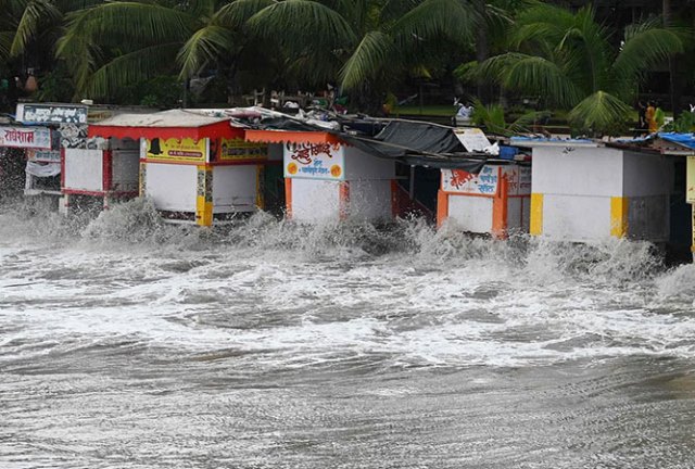
The landfall process of extremely severe cyclonic storm ‘Biparjoy’ has begun and it will continue till Thursday midnight, a senior weather scientist at India Meteorological Department (IMD) said.

“The landfall process (of cyclone ‘Biparjoy’) has commenced and it will continue till (Thursday) midnight,” Mrutyunjay Mohapatra, director general, Meteorology, IMD, told ANI.

Earlier, on Thursday, the IMD said cyclone ‘Biparjoy’ will cross Jakhau Port of Gujarat by Thursday night after making landfall as a very severe cyclonic storm (VSCS).

“Cyclone Warning for Saurashtra and Kutch Coasts: RED MESSAGE. VSCS BIPARJOY at 1130IST today near lat 22.8N & long 67.3E, about 140km WSW of Jakhau Port (Gujarat) and 190km WNW of Devbhumi Dwarka. To cross near Jakhau Port (Gujarat) by tonight as VSCS,” IMD said in a tweet on Thursday.

Meanwhile, Gujarat Chief Minister Bhupendra Patel chaired a review meeting at the State Emergency Operation Center in Gandhinagar on Thursday morning as cyclone ‘Biparjoy’ neared.

The IMD issued a Red alert for the Saurashtra and Kutch coasts on Wednesday, saying that VSCS (Very Severe Cyclonic Storm) ‘Biparjoy’ will cross Saurashtra and Kutch and adjoining Pakistan coasts, between Mandvi and Karachi near Jakhau Port, by Thursday evening.

Warnings about extensive damage to temporary housing structures and falling of trees and branches due to high-speed winds, high tides and heavy rainfall have already been issued by India Meteorological Department.

“Sea conditions will remain disturbed in the northeast Arabian Sea due to cyclone ‘Biparjoy’. All fishing operations should remain suspended. Offshore activities, port and industrial activities and oil explorations should be regulated today,” the director general of IMD said.

Preparations for protection against the cyclone are on in full swing on the Gujarat coasts. District authorities have also been sharing timely updates on evacuation measures and the provision of temporary shelters for evacuees.

Amid the approaching cyclone, National Disaster Response Force (NDRF) and State Disaster Response Force (SDRF) deployed teams in Gujarat on Wednesday. The teams set about evacuating people and livestock from low-lying, coastal areas to safely and mobilising other emergency measures to save lives and property. (ANI)

Read More: lokmarg.com

Cyclone Mandous In TN

Cyclone Mandous In TN: Roads Waterlogged, Trees Uprooted

Chennai and several other parts of Tamil Nadu witnessed heavy rainfall and strong winds amid cyclonic storm Mandous, which according to the India Meteorological Department (IMD) said had crossed the Mamallapuram coast and is weakening in strength after completing its landfall process late on Friday night.

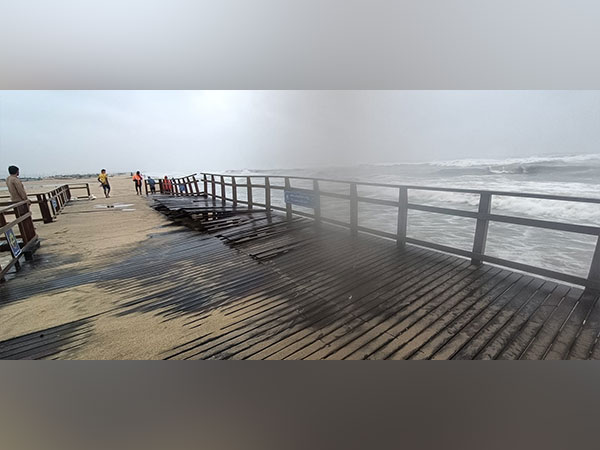
Several areas in Chennai saw waterlogging and squally winds uprooting trees in Chennai and in the nearby Chengalpattu district. The rainfall triggered by the Cyclone has caused severe Waterlogging in low-lying areas. Roads in the MMDA Colony in Chennai’s Arumbakkam were seen waterlogged. A video showed a large tree uprooted in Egmore, causing several damages to a petrol bunk nearby.

Cyclonic Mandous had made landfall off Mamallapuram on Friday evening influencing moderate to heavy rainfall in coastal Tamil Nadu.

Mandous is all set to weaken to a deep depression and later a depression on Saturday.

S Balachandran, DDGM, RMC Chennai, said “Cyclone Mandous crossed the coast and is in deep depression and its strength is weakening. It is moving towards the Northwest direction so areas in northwest districts will witness strong winds of 55-65 kmph which will further decrease by evening to 30-40 kmph.”

Earlier today, the Greater Chennai Corporation (GCC) requested people to avoid going out until Cyclone Mandous weakens. It is said that almost 65 trees fell in three hours and motor pumps are being used to remove water stagnation in low-lying areas.

Notably, National Disaster Response Force personnel are on standby. The Tamil Nadu government put out a list of helpline numbers in case of any flood-related emergencies.

The Greater Chennai Traffic Police Saturday in a tweet announced that vehicular movement along the East Coast Road (ECR) resumed at 6 am. The stretch had been closed since 10 pm last night, due to the cyclone.

Meanwhile, Tamil Nadu Chief Minister MK Stalin on Friday said that all the precautionary measures have been taken. “The government has taken all the precautionary measures and the officers are regularly monitoring the situation,” said Stalin.

Stalin visited and inspected the state emergency operation centre, Chepauk amid the cyclone’s severity. He said that the monitoring of the cyclone has also been deployed district-wise.

“Whatever the situation may be Government will ensure the protection of the people. District wise the monitoring of the cyclone has also been deployed,” said Stalin.

Stalin urged the people to follow the orders of the government and corporate with the government. Meanwhile, Dindigul Collector has declared a holiday for schools and colleges in Sirumalai and Kodaikanal for Saturday.

Heavy rains with strong winds were experienced in Puducherry on Friday. Red alerts were sounded in Tamil Nadu, Puducherry, and Andhra Pradesh.

Doppler Weather Radar Karaikal and Chennai are monitoring the cyclone. (ANI)

Read More: http://13.232.95.176/