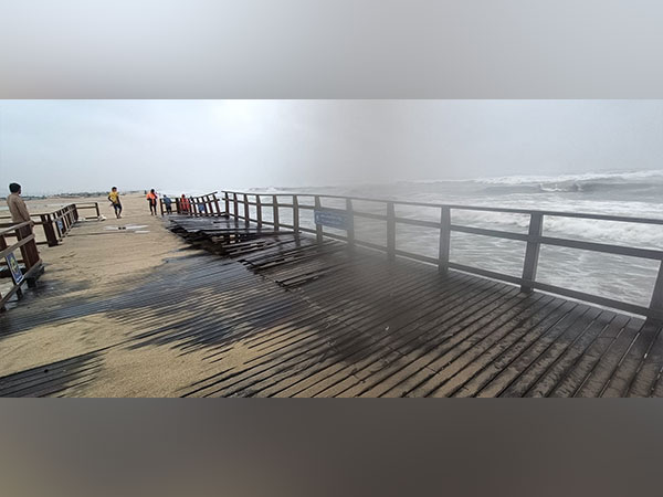
sea cyclonic storm Mocha

Cyclone Mocha To Make Landfall Along Myanmar-Bangladesh Coast Today: IMD

The extremely severe cyclonic storm “Mocha” is likely to cross between Bangladesh’s Cox’s Bazar and Myanmar’s Kyaukpyu, close to Sittwe around Sunday noon, said Indian Meteorological Department (IMD).

“The ESCS “Mocha” lay centered at 0530hrs IST of 14th May 2023 over Northeast & adjoining Eastcentral Bay of Bengal near lat 18.7N & long 91.5E. Its likely to cross between Cox’s Bazar (Bangladesh) & Kyaukpyu (Myanmar), close to Sittwe (Myanmar) around noon of today,” IMD tweeted.
In West Bengal’s South 24 Parganas, civil defence teams have been deployed at Bakkhali Sea Beach as Cyclone ‘Mocha’ intensifies into an extremely severe cyclonic storm.

They said that the members of Civil defence teams are continuously alerting the public and tourists and asking them to remain alert and avoid coming to the beach and areas close to the sea.

“The condition is not good. We are continuously alerting the public and tourists to be alert and avoid coming to the beach,” Anmol Das, a civil defence official said.

Earlier, National Disaster Response Force (NDRF) has also deployed 8 teams and 200 rescuers in West Bengal’s Digha after warnings about cyclone ‘Mocha’ intensifying into a severe storm.

“We’ve deployed 8 teams. 200 rescuers of NDRF deployed on the ground and 100 rescuers on standby,” NDRF officials said earlier.

“This is the first cyclone to threaten Myanmar this Monsoon season and there are grave concerns about the impact especially on already vulnerable and displaced communities,” Al Jazeera reported citing the United Nations Office for the Coordination of Humanitarian Affairs (UNOCHA) on Friday.

According to the report, more than 230,000 Rakhine residents reside in displaced persons’ camps that are “located in low-lying coastal areas susceptible to storm surge.”

According to UNOCHA, around six million people in the storm’s projected path in Rakhine and the three northwesterly states of Chin, Magway, and Sagaing already required humanitarian aid.

Authorities have issued warnings about the risks of flooding, landslides, and a storm surge of 2 to 2.7 metres (6.6 to 8.9 feet) in height. (ANI)

Read More: lokmarg.com
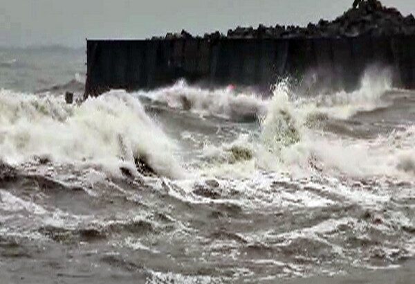
Normal Monsoon year

Normal Monsoon Is Expected This Year: IMD

India was likely to experience a normal monsoon this year, a top IMD scientist said on Tuesday.

Speaking to ANI, Mrutyunjay Mohapatra, director general, of Meteorology, India Meteorological Department, said quantitatively, the seasonal (June to September) rainfall over the country during the southwest monsoon, as a whole, is likely to be 96 percent of the Long Period Average (LPA) with a model error of +- 5 percent (Normal).
Long-period average rainfall over the country, as a whole, based on data from 1971-2020 is 87 cm, added the IMD official.

It is based on both statistical and dynamic models used by IMD.

La Nina conditions have changed to Neutral conditions over the equatorial Pacific region, the top IMD official said, adding that the latest climate model forecast indicates that El Nino conditions are likely to develop during the monsoon season.

The impact of El Nino may be felt during the second half of the monsoon season, he added.

All El Nino years are not bad monsoon years, he said, informing that about 40 percent of the EL Nino years in the past(1951-2022) were years with normal or above-normal monsoon rainfall.

“Neutral Indian Ocean Dipole IOD conditions are prevailing over the Indian Ocean and the latest climate models forecast indicates that positive IOD conditions are likely to develop during the southwest monsoon season. Positive IOD is good for southwest monsoon over the country,” Mohapatra said.

The rainfall in Eurasia was below normal from December 2022 to March 2023, he informed further, adding that lower snow cover over the Northern Hemisphere as well as Eurasia during winter and spring is favorable for the subsequent southwest monsoon rainfall over India. (ANI)

Read More: http://13.232.95.176/

Cyclone Mandous In TN

Cyclone Mandous In TN: Roads Waterlogged, Trees Uprooted

Chennai and several other parts of Tamil Nadu witnessed heavy rainfall and strong winds amid cyclonic storm Mandous, which according to the India Meteorological Department (IMD) said had crossed the Mamallapuram coast and is weakening in strength after completing its landfall process late on Friday night.

Several areas in Chennai saw waterlogging and squally winds uprooting trees in Chennai and in the nearby Chengalpattu district. The rainfall triggered by the Cyclone has caused severe Waterlogging in low-lying areas. Roads in the MMDA Colony in Chennai’s Arumbakkam were seen waterlogged. A video showed a large tree uprooted in Egmore, causing several damages to a petrol bunk nearby.

Cyclonic Mandous had made landfall off Mamallapuram on Friday evening influencing moderate to heavy rainfall in coastal Tamil Nadu.

Mandous is all set to weaken to a deep depression and later a depression on Saturday.

S Balachandran, DDGM, RMC Chennai, said “Cyclone Mandous crossed the coast and is in deep depression and its strength is weakening. It is moving towards the Northwest direction so areas in northwest districts will witness strong winds of 55-65 kmph which will further decrease by evening to 30-40 kmph.”

Earlier today, the Greater Chennai Corporation (GCC) requested people to avoid going out until Cyclone Mandous weakens. It is said that almost 65 trees fell in three hours and motor pumps are being used to remove water stagnation in low-lying areas.

Notably, National Disaster Response Force personnel are on standby. The Tamil Nadu government put out a list of helpline numbers in case of any flood-related emergencies.

The Greater Chennai Traffic Police Saturday in a tweet announced that vehicular movement along the East Coast Road (ECR) resumed at 6 am. The stretch had been closed since 10 pm last night, due to the cyclone.

Meanwhile, Tamil Nadu Chief Minister MK Stalin on Friday said that all the precautionary measures have been taken. “The government has taken all the precautionary measures and the officers are regularly monitoring the situation,” said Stalin.

Stalin visited and inspected the state emergency operation centre, Chepauk amid the cyclone’s severity. He said that the monitoring of the cyclone has also been deployed district-wise.

“Whatever the situation may be Government will ensure the protection of the people. District wise the monitoring of the cyclone has also been deployed,” said Stalin.

Stalin urged the people to follow the orders of the government and corporate with the government. Meanwhile, Dindigul Collector has declared a holiday for schools and colleges in Sirumalai and Kodaikanal for Saturday.

Heavy rains with strong winds were experienced in Puducherry on Friday. Red alerts were sounded in Tamil Nadu, Puducherry, and Andhra Pradesh.

Doppler Weather Radar Karaikal and Chennai are monitoring the cyclone. (ANI)

Read More: http://13.232.95.176/