Uttarakhand Red alert IMD

IMD Red Alert For U’khand For August 13-14

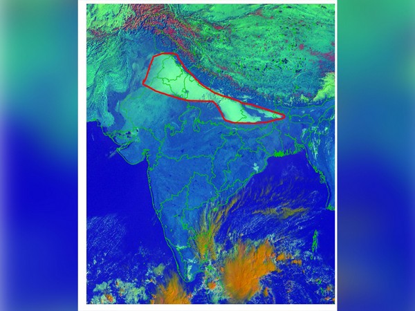
The Indian Meteorological Department on Saturday issued a red alert for Uttarakhand for August 13 and August 14.

As per IMD, heavy rainfall is also likely over Uttarakhand on August 13 and 14. 

“Urgent red alert issued for Uttarakhand as heavy to very heavy rainfall, reaching extremely heavy levels (more than 204.4 mm), is forecasted for August 13th and 14th. Stay safe,” India Meteorological Department tweeted. 

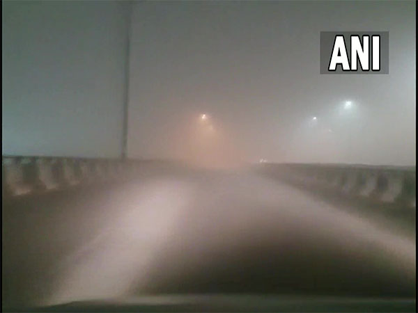
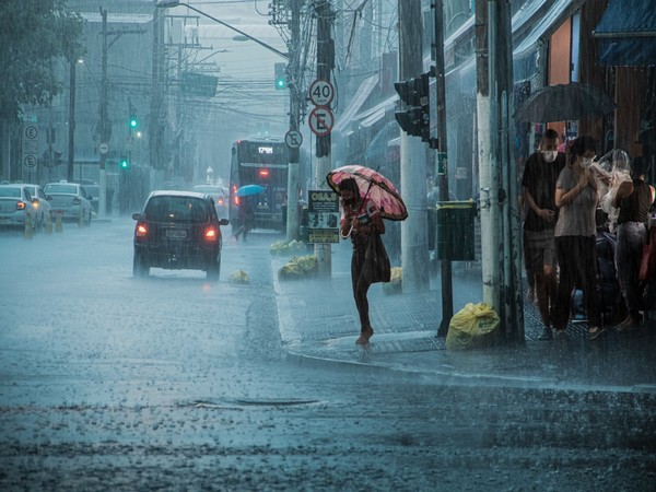
There has been heavy rain in many districts of the state for the last couple of days, causing waterlogging and flooding and disrupting the normal lives of the people.

Earlier, five pilgrims were killed after a car they were travelling in was buried under the debris of a landslide at Tarsali under Chowki Phata in Uttarakhand’s Rudraprayag district, police said on Saturday.

According to officials, the victims, including one from Gujarat, were on their way to Kedarnath when the incident took place on Thursday evening.

The incident also led to the blocking of the Guptkashi-Gaurikund highway leading to Kedarnath Dham for traffic on Friday, said officials, while adding that about 60 metres of the road had been badly damaged and washed away.

Many districts of the state, including Rudraprayag, have been witnessing incessant rain for the last couple of days. (ANI)

Read More: http://13.232.95.176/

Delhi Wakes Up To Dense Fog As Cold Wave Continues In NCR | Lokmarg

Delhi Wakes Up To Dense Fog As Cold Wave Continues In NCR

Cold wave continued in the national capital as the minimum temperature in Delhi was recorded at 7 degrees Celcius on early Tuesday morning.

Dense fog was observed as the cold wave continued in Delhi.
Earlier on Monday, the India Meteorological Department predicted cold day/severe cold day conditions in Delhi.

“Cold Day/Severe Cold Day Conditions very likely in some parts over Punjab, Haryana, Chandigarh, Delhi, and West Rajasthan and cold day conditions in isolated pockets over Uttarakhand on 26th and 27th December 2022,” IMD had said in a bulletin at 3.30 pm on Monday.

The weather department had also predicted dense to very dense fog in Delhi and nearby regions.

“Due to prevailing light wind and high moisture in lower tropospheric levels, Dense to Very Dense Fog is very likely to continue over some parts of Uttarakhand, Punjab, Haryana, Chandigarh & Delhi, and West Rajasthan during the next 48 hours,” the IMD said on Monday.

Earlier on Monday, the national capital New Delhi reeled under a cold wave and foggy conditions. Delhi on Sunday recorded a minimum temperature of 5.3 degrees celsius while most parts of northern India witnessed temperatures in a range between 3 to 7 degrees Celsius said India Meteorological Department (IMD) on Monday. (ANI)

Read more: http://13.232.95.176/

Dense Fog Grips Large Parts Of Northern India | Lokmarg

Dense Fog Grips Large Parts Of Northern India

Large parts of several states in North India were covered with dense fog on Wednesday morning leading to major delays in train and flight movements.

Visibility in Amritsar (Punjab), Hisar (Haryana), Sri Ganganagar (Rajasthan), Pantnagar (Uttarakhand), besides in Uttar Pradesh’s Bareilly, Bahraich, and Gorakhpur was recorded at 25 meters around 8.30 am as per India Meteorological Department.
At the same time, visibility in Punjab’s Ludhiana, Haryana’s Karnal, Churu (Rajasthan), Varanasi (Uttar Pradesh), Bihar’s Patna and Purnea, and Tripura’s Agartala was at 50 meters.

Meanwhile, in Haryana’s Ambala and Bhiwani, and Uttar Pradesh’s Lucknow and Fursatganj, the visibility was recorded at 200 meters.

Visibility in Mandi (Himachal Pradesh), Chandigarh, Rohtak (Haryana), Safdarjung, Palam, Sultanpur, Gaya, and Dhubri was 500 meters.

“Visibility recorded (0830 IST)(meter): 25- Amritsar, Hissar, Ganganagar, Pantnagar, Bareilly, Bahraich, Gorakhpur; 50- Ludhiana, Karnal, Churu, Varanasi, Patna, Purnea, Agartala; 200- Ambala, Bhiwani, Lucknow & Fursatganj; 500- Mandi, Chandigarh, Rohtak, Safdarjung, Palam, Sultanpur, Gaya & Dhubri,” IMD tweeted.

Earlier on Wednesday, India Meteorological Department (IMD) predicted the continuation of a dense layer of fog from Punjab and Northwest Rajasthan to East Uttar Pradesh across Haryana.

“INSAT 3D RAPID Satellite imagery shows a continuation of Dense fog layer from Punjab and Northwest Rajasthan to East UP across Haryana. Gray circled cloud patch, over central parts of West UP, is Medium & High clouds associated with middle tropospheric level westerly trough and the fog layer lies below it,” IMD tweeted.

“Visibility (meter) recorded at 0530 hrs IST today: Amritsar-25, Bhatinda-0, Ganganagar-25, Ambala-50, Bareilly-25, Bahraich-50, Varanasi-50,” IMD added. (ANI)

Read more: http://13.232.95.176/

Heavy Rains In Pondicherry

Heavy Rains In Pondicherry, TN On Dec 8: IMD

A low-pressure area forming over the Southeast Bay of Bengal and the adjoining south Andaman Sea is likely to bring very heavy rainfall in Pondicherry and seven districts of Tamil Nadu on December 8, said the India Meteorological Department (IMD) in a press release on Sunday.

As per IMD, a trough is present from the Comorin area to the north Kerala coast at 0.9 km above the mean sea level.
A low-pressure area is likely to form over the southeast Bay of Bengal and the adjoining south Andaman Sea by December 5, which is expected to move north-westwards before concentrating into a ‘Depression’ over the Southeast Bay of Bengal by December 7 morning.

Thereafter, the ‘low-pressure area’ is likely to continue to move west north-westwards, and reach the Southeast Bay of Bengal, near north Tamil Nadu-Puducherry and adjoining south Andhra Pradesh coasts by December 8 morning, the release further stated.

IMD also informed us about the likely rainfall situation for the next three days.

On December 5, light to moderate rainfall is likely to occur at a few places over South Tamil Nadu, North Tamil Nadu, Puducherry, and Karaikal area.

On December 6, light to moderate rain will likely occur at one or two places over Tamil Nadu, Puducherry, and Karaikal area.

On December 7, light to moderate rain is expected in many places. Also, isolated thunderstorms and lightning is likely to occur over the coastal Tamil Nadu, Puducherry, and Karaikal area.

While light to moderate rain with thunderstorms and lightning is likely to occur at one or two places over interior Tamil Nadu, heavy rains are likely at isolated places over Cuddalore, Mayiladuthurai, Thanjavur, Tiruvarur, Nagapattinam and Pudukkottai districts of Tamilnadu and Karaikal.

On December 8, light to moderate rain is expected in many places with isolated thunderstorms and lightning likely to occur over Tamil Nadu, Puducherry and Karaikal areas.

Other than this, heavy to very heavy rain is likely to occur at isolated places over Villupuram, Cuddalore, Mayiladuthurai, Thanjavur, Tiruvarur, Nagapattinam, and Pudukkottai districts of Tamil Nadu, Puducherry, and Karaikal. (ANI)

Read More: http://13.232.95.176/